Article by Nja Beltin Tekuh
The Adamawa plateau is dubbed the “water tower” of Cameroon, since a large number of the country’s rivers rise in the area. This major catchment area as well as the river courses and lakes have been modified significantly. This modification has come from land use intensification and the construction of dams along river courses (Molua and Lambi, 2006). Such transformations have disrupted the regular pattern of flow of most rivers in this part of the country and this has equally affected other human activities. Massive deforestation for agricultural purposes has contributed to increasing seasonality of streams. This is because forest clearance has reduced infiltration and consequently the recharge of groundwater. Delayed recharge of groundwater has widened the flow gap between low and high waters of streams.
Closely linked to this is the element of grazing, especially in the cattle grazing area of the Adamawa which is the main watershed of Cameroon. Most water points for cattle have disappeared over the years and the streams have become highly seasonal because of increased evaporation. The trampling effect of grazing animals makes the soil less porous and thus less able to absorb water, especially during rainy season (Lambi 2001). The constructions of dams and water-diversion systems such as the Lom Pangar dam, blocks migration routes for fish and disrupts fresh water habitats.
The Adamawa plateau is a band of terrain that ranges from 1,000 to 2,000 m in altitude (averaging about 1,100 m) and stretches from Nigeria to the CAR. Altitude dips to as low of 500 m in the Djérem and Mbéré valleys and at the border north of Ngaoundéré. Though the plateau is chiefly in north-central Cameroon, the part of it known as the Gotel Mountains is in southeastern Nigeria.
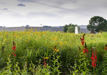
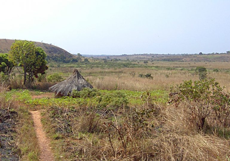
The Adamawa plateau forms part of the Cameroon Volcanic Line and is characterized by numerous lakes extending east of the Central African Republic and southwest-ward to the western Cameroon Highlands and the Atlantic coastal plain. The area is located at the transition between the humid equatorial climate to the south and the tropical dry Sudano – Sahelian climate to the north. The Adamawa plateau is characterized by a highly diverse plant community due to its late Quaternary climate history. The modern dominant biome is a wooded savannah (Letouzey, 1968, 1985; White, 1983) although combined anthropogenic pressures today (including fire, crop cultivation and grazing) have led to its degradation to more open herbaceous vegetation in turn inducing increased soil erosion leading to unhealthy sediments and nutrients which enter into drinking water sources affecting humans and aquatic organisms such as fish, amphibians, reptiles etc. Guineo-Congolian semi-deciduous forests dissect the Adamawa plateau along permanently humid valleys. Submontane/montane trees (e.g. Olea) occur in ravines from around 1700 m on Mount Nganha (Letouzey, 1968, 1985) in restricted areas where locally humid edaphic conditions compensate for rainfall deficit during the dry season.
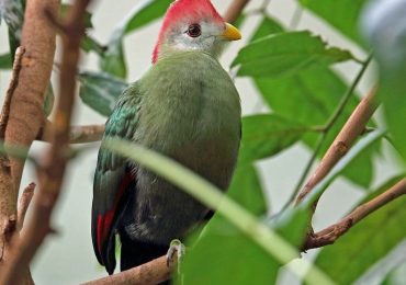
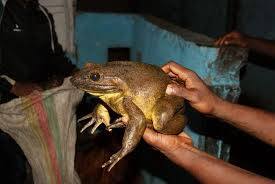
The vegetation is dominated by savannah species such as Annona senegalensis, Antidesma venosum, Bridelia ferruginea, Cussonia barteri, Entada africana, Lannea kerstingii, Maytenus senegalensis and Terminalia glaucescens. Sterculia tragacantha, a semi-deciduous forest species, is also occasionally present (Tchotsoua, 2005). The endangered toad Amietophrynus djohongensis is known to exist in the wild only in the Cameroonian part of the Adamawa Plateau (Darrel, 2015). The plateau is also an Important Bird Area with about 525 birds species including 13 species which are globally threatened (Birdlife, 2016). The plateau is the source of numerous rivers such as Benue, Mayo Deo, Faro River, Mbéré and Vina which eventually merge to form the Logone River, Mbam, Kim, Lom and Djérem River. The Djérem eventually becomes the Sanaga River and Mbam, Kim and Lom rivers ultimately empty into it. A long history of volcanism has also created a number of crater lakes in the area, the results of collapsed volcanoes filling with water.
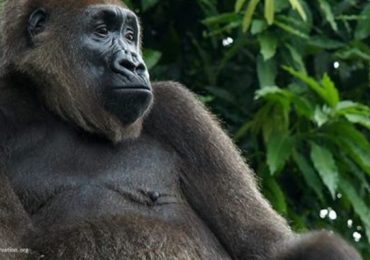
Among the most well-known are Lakes Tison (Tyson, Tisson) and Mbalang near Ngaoundéré. The area has two protected areas (Bouba Njida and Mbam et Djérem National Parks) which host diverse species of birds and mammals such as antelopes, elephants, chimps, monkeys, hippopotamus etc.