A lack of good maps has undermined Cameroon’s development and environmental conservation for a long time. Existing maps are not considered suitable for spatial planning or policy-making. For one, they have made it hard to optimize development in rural areas, reduce social conflicts between communities and investors, and conflicts between ministries. Now, stakeholders want to establish national standards for mapping the country’s land areas, including better information about community land and resource use.
By Azore Opio
Over the past year, a project funded by the European Forest Institute (EFI) has been working hard to support the Ministry of Economy, Planning and Regional Development (MINEPAT)to compile better maps of the South West Region.
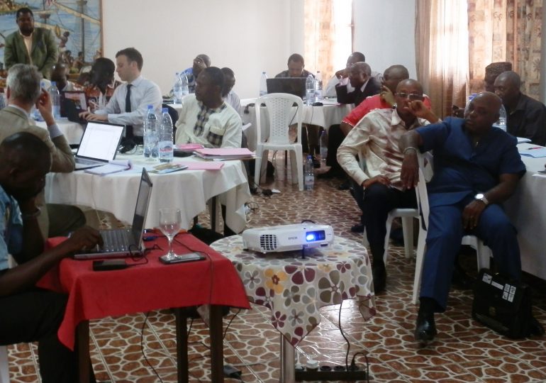
In a restitution meeting that held in Buea on February 25, 2016, the MINEPAT representative, Prof. Soh Fotsing, underlined how accurate and up-to-date maps are essential tools to inform a number of new land use planning initiatives being spearheaded by MINEPAT, as envisaged in the 2011 Orientation Law on Land Use and Sustainable Development Planning.
The LTS team leader James Acworth recalled the objective of the project, which is to design and test a mapping tool to improve the transparency of spatial planning in Cameroon. The mapping tool will make available various types of information to those who need it during multi-stakeholder land use planning processes at Council and Regional levels.
“Until today, much of the spatial information needed for planning was missing altogether. What existed was inaccurate, out of date or scattered in many different places making it very difficult to get and overlay in such a way to allow comparison and analysis of multiple types of data about the same place. Spatial information was also unequally accessible – some could get map data, but many could not,” said Acworth.
During an intensive first year of activities, the project team led by LTS International and Rainbow Environment Consult, has fostered collaboration with many partners: various Ministries (led by MINEPAT), Government agencies (IRAD, and the National Herbarium) and programs (the National Community Driven Development Program, PNDP; and the Programme for Sustainable Management of Natural Resources in the SW Region – PSMNR), research institutions (the International Institute for Tropical Agriculture, IITA; and the International Institute for Applied Systems Analysis, IIASA) and NGOs (World Resources Institute, WRI; Rainforest Foundation UK, RFUK; Forêts et Développement Rurale,FODER; Ajemalibu Self Help, AJESH; Centre pour l’Environnement et le Développement, CED; Forest People’s Program, FPP; and the Tropical Plants Exploration Group, TroPEG); and last but not least, the Municipal Council, traditional leaders and communities of Nguti.
With Nguti Council in the South West Region chosen as a pilot location, partners have developed standards for collecting and compiling spatial data, and have generated many useful maps for land use planning:
• An oil palm suitability map (IIASA);
• A cocoa suitability map (IITA);
• A botanical diversity map (National Herbarium, Oxford University, TroPEG and PSMNR);
• An accessibility map (LTS using data from MINTP and RFUK);
• Community Maps for Nguti Communities (AJESH FODER and RFUK);
• Updated data on settlements and roads on Open Street Map;
• Existing data about forest, agricultural and mining concessions, Protected Areas, Council and Community Forests have been made available by the respective ministries.
These maps are now shared via an Online Mapping Platform developed by WRI that is soon to be released on a MINEPAT web portal.
It is hoped that this initiative will create a more precise reference that will help government and otherstakeholders to access, analyse and present information in standard form during land use planning consultations.
The initiative will, according to Acworth, allow stakeholders to test different land use scenarios and facilitate multi-stakeholder dialogue to reach better land use decisions in future.
“We are looking for a common approach to land use planning that is well informed by accurate information and affordable,” Acworth told journalists at the restitution meeting.
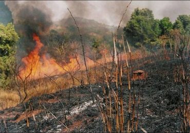
The project’s next one-year phase aims to support MINEPAT develop and test guidelines for participatory local land use planning, a process deemed essential to stopping the perennial inter-sectoral conflicts and social conflicts as well as creating an enabling environment for the National REDD+ Strategy.
The meeting concluded with all participants expressing their hopes that this spirit of collaboration will continue to grow – and that other government and non-government organisations will contribute more spatial data and ideas towards successful land use planning in Cameroon.
Stakeholders Forward Final Land Use Mapping Tools For Endorsement