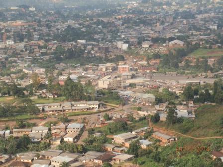
A new master plan developed by a panel of experts holds great promise for the modern development of Bamenda City in the North West Region. The 2005 population census ranks Bamenda as the third largest town in Cameroon with a population of 269.530 after Douala and Yaounde.
By Azore Opio
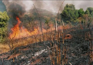
Land use patterns in developing and underdeveloped nations are chaotic due to lack of planning and systematic land development; consciously or unconsciously perpetuated. Consequently, land acquisition, occupation and use often takes a confrontational and a hit-and-miss lead.
Cameroon’s urban centres suffer immense physical problems. Housing presents clusters of alarming dereliction. Traffic usually snarls up at commuters like a multitude of wild, hungry dogs; kicking up deafening noise and choking dust. Time is of no essence to the traffic that jams often on dilapidated roads.
It is this due to this exasperating circumstance that retired town planner, Zachary Fru Nsutebu, under the auspices of the concerned ministry, has set out to redress.
Nsutebu has drawn up a wide land use master plan and rules for Bamenda city.
The land use plan has been approved by the Senior Divisional Officer for Mezam Division, North West Region, Nguele Nguele Felix, in accordance with Part III, section 39, article 3 of Law No. 2004/003 of 21 April 2004 to regulate Town Planning in Cameroon.
The plan, if implemented at all, would redeploy homes, work places, strike a correct balance between new urban motorways, public transport, parking and sewage collection, treatment and disposal.
“We have estimated the carrying capacity of Bamenda city and think that we can avoid the common fallacy of spreading towns horizontally, by freeing ground space tower blocks, redirecting traffic and decongesting our urban centres,” Nsutebu told The Green Vision.
If cleverly sited, Cameroon’s towns would have more sunlight, fresh air and freer ground circulation while enhancing the beauty, variety and contrast which ought to be the essence of urban centres.
According to the Bamenda wide land use plan, the proposed concept of community organization is based on protecting and conserving a green belt around the proposed planning area; containing urban development within the proposed planning area and excluding through traffic from the limits of the proposed planning area.
Taking into account that the city centre is not a transit node but an activity area to work, go to school, obtain services, recreate or entertain and return to your origin, the plan is aimed decongesting the city centre and make “it a safe place to relax for all at all times.”
It proposes a road network for Bamenda that would minimize traffic through the inner area in general and the city centre in particular.
“People should only come to the city centre because they need a service or have something to do there. Those entering Bamenda should be provided with options to reach their destinations without losing time and cost. It is also necessary to provide a wide range of choices to different destinations within the city,” says the plan.
The plan further offers an overall transport goal for Bamenda to ensure the smooth, safe and comfortable movement of goods and people in and out the city at minimal cost and travel time. According to the plan, in order to achieve the aforementioned transportation goal, it is necessary to improve on the state of road networks; ensure a coherent and sustainable hierarchy of road network; increase and upgrade traffic exchange nodes; increase access to residential neighbourhoods and land parcels and improve on parking facilities both in commercial areas, work places and activity area